
Challenges are still emerging. But lessons learned have been very revealing.
Many design and innovation requirements were seen while compiling the world's largest GPS atlas for food and culture.

The goal is to efficiently recommend "refreshing" valuable places and experiences for artists, travelers, diners and well-educated pedestrians. Affordable visits offering rich experiences.
It could be a free visit to where an inspired quote was written by a writer or a soulful meal for under $10.

More and more, however, mobility users have less and less time or desire to stop and browse yet another new thing on a cluttered phone, disrupting real-life travel and conversations.
Content needs to be highly-valued and personalized in curation.

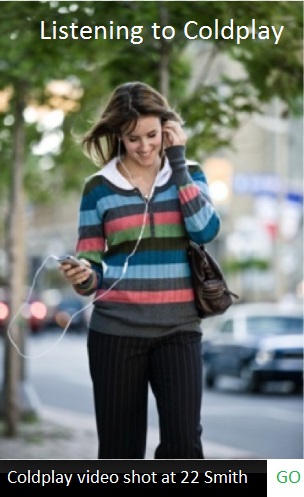
Visuals need to be very minimalist if not invisible. Audio experiences for music, a car GPS system or Siri enable less obligation to go to a screen. They compliment an activity in real-life more than disrupting it. But they also take up more battery power. GPS also takes up more data usage.

Any audio narration also needs to be clearly heard like in public transit through the din of subway noise. Words need to be organized for clarity in the din. Unfamiliar words need to be bracketed by familiar words...to pay attention to anything foreign.

It would be nice to ask your watch a question and it tells you succinctly where to go and exactly what you want to know with an interesting brief story.
Question: Where is the nearest noodle place?
Answer: Turn right at next street, go to 50 Main St, you will find a soba shop (recommended by artists). Soba was imported by 13th Century Chinese monks to Japan who then asked local candy confectioneries to help make it.

Question: Where did Bob Dylan write Blowin' In the Wind?
Answer: In April, 1962, Bob Dylan wrote Blowin' In the Wind at Fat Black Pussycat at 11 Minetta, New York, NY.

Related Answer: You can find the album cover location for The Freewheelin' Bob Dylan (1963) at 9 Jones nearby:

Designing for mobile is almost like designing for the blind. There is much less capability to see a screen while in motion. It needs to be practical and efficient.

On the go design is like design for a driver who cannot really see a screen fully. Everything you see in a car is designed for partial visual impairment. A GPS guide should depend less on disrupting a pedestrian for browsing and typing. It should enhance going somewhere.

Ingesting personal interest cues from mobility users - what they want to explore in food and music e.g. - at any given moment in time would help sort out what highlights to put in a window of time reaching a user at a specific GPS location.
A key challenge is narrowing down just enough highlights from dozens to thousands of interesting location experiences in the database.
Routes packaged by others as having been interesting will be very useful. Routes themed by taste, topic, convenience and affordability. Best 10 places near your AirBnB or any address.

Options to branch out into a certain direction need to be available: More noodle choices, more Bob Dylan choices.
It is about personal desire at that time and can't miss experiences recommended by other artists, budget travelers, diners and well-educated pedestrians. This is the thing to do here.

For related discovery, a user might also want to learn about faraway places related to a topic: Honke Owariya in Kyoto, Japan, has been open since 1465 and served soba since 1700.

A user might also want to learn about nearby places related to a topic: Bob Dylan lived near where he wrote Blowin' In the Wind at 161 W 4th St and 94 MacDougal:

Users can connect relationships to improve the intelligence of a GPS database in recommendations. They can package (list) places for a discovery route.
Initially tags, geographic vicinity and algorithms related to personal interests can rank recommendations.
No different than a car GPS system, standardized visual cues for directions and geographical beacons offer familiarity. The more familiarity framing a new place or story the better.


All else could be too heavy a read while in motion.
Elements of simplicity and familiarity need to be prioritized:
1) Familiar photo of Bob Dylan or Soba
2) Familiar name of what was searched in voice command or text inputs with address.
3) (+) Quick caption story in audio and text formats.
4) Route to get there (GO).
5) Recommendations along route (nearby tagged) or related to search (faraway tagged).
This is the zen of less is more. Navigation for the nearly blind.


Color cues need to be considered to differentiate topics (music from food e.g.) and names of people from places in recommendations. Maps are the art of color codes and symbols to quickly see things on the go. So are road signs and lights.

Design less for the web (or even a mobile app) and more for the road.
But discovery routes are not always geographical. They can be relational -- connected by people, topics, and dates in history. A genealogy connected by tags.
A place is also layered by many histories in time. Different stories connected by one place.
There are many interesting combinations that can be rendered. This is the art of pairing and networking items for discovery.
* * *
Navigation modes can be audio-only, audio and text, audio and visuals with text. No audio. Food content only. Music content only. Food and Music only. Various cultural terrains and combined views. Exploration can also connect topics, people and time independent of proximity for discovery.
Navigation can also be driven by practical needs (food, transportation, accommodation, time, cost etc). Your exploration agenda could be driven by this.
Personalized views matter. Points of interest based on your music playlists, books, digital life, locations visited, search history, tastes, interactions with locations, etc.
You may or may not be a Bob Dylan fan.

You may only have time to visit 3-4 places. Value and proximity become factors.
Food and meeting places are perhaps the most frequent call to actions. Where can I eat? Where should we meet? Good deals are needed for artists, travelers, families and pioneering start up founders. The most valuable experiences per dollar spent at a location.

Metaphorically, you do not just want your GPS to tell you where a gas station is, but also what is the best value nearby.
Locations can also be optimized for night (bars, dinner, music venues), day (coffee shops, urban exploration) and morning (breakfast). Locals or travelers. Hours of the day. Types of activities. Modes of travel (foot, bike or car). A contextual itinerary.
The best guide will build a compelling, efficient and valuable itinerary. THE List.
Music needs to be optimized by era and personal taste (playlists). Food is more universal (but still has categories like Mexican or Chinese).
The base topography for a guide is ideally food. You can see it in Google Maps. It is something needed at least 3x a day plus any bars and event venues.

But there are too many choices (all choices). The best guide will filter out the best places. A must-dine place that artists love which you can afford, highlighting a must-have dish. And nearby you can explore other cool experiences before or after dining. A curated package.
Down the road, it later makes total sense to combine WeChat like scan-to-pay services with the best recommendations for affordable delicious food and travel, offering specials for frequent or first-time visitors.
Welcome. Welcome Back.


